USLakeFront Lake survey & intelligence
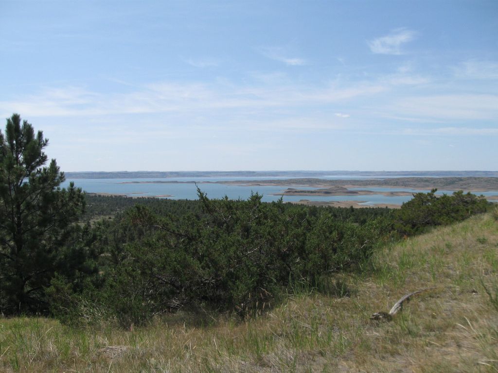
Fort Peck Lake (5346035133).jpg
USFWS Mountain-Prairie · CC BY 2.0 · Wikimedia Commons
LakesMontana → Fort Peck Lake

Fort Peck Lake

Montana · Reservoir impounded 1940 · near Fort Peck

245,000 acres 220 ft deep 8 ft clarity Water C
Compare
5.2SCORE
Survey summary · Montana
245,000
Surface acres
220 ft
Max depth
1,520 mi
Shoreline
8 ft
Typical clarity
2,246 ft
Elevation

Photographs of Fort Peck Lake via Wikimedia Commons. Credit and licence on each image — hover to view, click through to the source.

Fort Peck Lake covers 245,000 acres in Montana and drops to 220 feet at its deepest point. It is a reservoir impounded in 1940 and managed by USACE. Water level is the thing to understand here: the pool can move roughly 20 feet, typically drawn down in autumn. That changes dock function, boat access, and what the shoreline looks like in listing photos versus in person. Short-term rental posture: Very limited. Confirm at the municipal level before underwriting rental income.

What stands out

  • Deep water — 220 ft max
  • Large open water, 245,000 acres
  • 1520 miles of shoreline
  • Fishing
  • Boating

Watch outs

  • Seasonal drawdown near 20 ft — verify dock reach at low pool
  • Multi-year level volatility; review historical pool elevation before buying
  • USACE shoreline permitting — private dock approval is not guaranteed

Score breakdown

WATER RECREATION VALUE ACCESS INVESTMENT
Water 5.5
Recreation 7.2
Value 4.1
Access 7.3
Investment 1.9

Each axis is computed by published formula from this lake's own attributes. How we score.

Water quality grade
Water A
ExcellentClear, low-nutrient water. Typically oligotrophic with high clarity and little seasonal algae.
Water B
GoodHealthy water with moderate clarity. Some seasonal variation, no persistent problems.
Water C
FairProductive water — good fishing, reduced clarity. Algae possible in late summer.
Water D
PoorNutrient-rich or heavily drawn down. Swimmable conditions vary; check before you rely on them.

Computed from measured clarity, trophic state, and drawdown magnitude — not an opinion. See the formula.

Overall score, 1–10
8.0+
ExceptionalStrong on every axis we measure.
7.0–7.9
StrongClearly above average, usually with one standout axis.
6.0–6.9
SolidA good lake with a trade-off worth understanding.
5.0–5.9
MixedReal strengths and real compromises.
Under 5
CompromisedSomething material — volatility, water quality, or access.

Weighted: water 26% · recreation 22% · investment 20% · value 18% · access 14%.

Fishery

WalleyeNorthern pikeChinook salmonLake trout

On the water

FishingBoatingHuntingPaleontology
No USGS gauge on this lake. We only publish a station when its own name matches this water body. Nearby gauges on other lakes would look like data and mislead you, so we show nothing instead. Why we do that.
2.08 ft
Gage height
2021-10-01 · 1769 days old

Gauge history

Daily values from USGS. Loading up to one year.

What the drawdown looks like

Full pool vs autumn low · Fort Peck Lake
20 ft FULL POOL AUTUMN LOW

The dock sits at full-pool elevation. At low pool the waterline retreats and the reach to navigable water changes. Scale is illustrative; the 20 ft figure is from published operations for this lake.

Where it is

True shoreline from USGS NHD 944 km²

The outline is this lake's actual boundary from the USGS National Hydrography Dataset, not an approximation — 405 boundary points. Basemap is USGS topographic with contours and hydrography. Switch layers at the top right.

Depth profile

SURFACE 220 ft max avg 70 ft

Idealized cross-section. Max depth 220 ft, average 70 ft. Depth at a specific dock depends on local bathymetry — verify at the property.

Level behaviour

Level stabilityVolatile Typical drawdown20 ft Drawdown seasonAutumn Trophic stateMesotrophic Typical clarity8 ft Water quality gradeC Elevation2,246 ft Managing authorityUSACE
This lake moves. A drawdown near 20 feet changes dock reach, boat access, and the look of the shoreline. Tour in the low season, or at minimum look at the gauge history above before you offer.

Dock & shoreline

Permitting authorityUSACE Omaha District Wake / speed rulesOpen water
A dock is never guaranteed. Confirm in writing with USACE Omaha District that the specific parcel is eligible before you remove contingencies.

Short-term rental posture

Very limited

Generally permitted, but rules change. Confirm the specific municipality and any HOA covenant.
Model rental income →
Modeled estimates. Market figures are derived from lake attributes and regional patterns, not from MLS data. Treat them as a starting point, not a comp.
$740,000
Median waterfront
$3,469
Per shoreline foot
-1.9%
Year over year
208
Est. inventory
58
Avg days on market
$265
Est. nightly rate

Rental snapshot

Modeled occupancy35% Booked nights / yr92 Gross revenue$29,692 Net operating income$12,464 Yield on median price1.68%
Open the full model →

What a median-priced home on Fort Peck Lake actually costs to carry, with waterfront-specific line items most calculators omit.

$6,191
All-in per month
$169,010
Cash to close + setup
$16,630
Beyond P&I, tax, insurance
Where the annual cost goes
$74,295 PER YEAR
Principal & interest $46,787 (64%) Maintenance reserve (1.1%) $8,140 (11%) Property taxes $7,770 (11%) Hazard insurance $3,108 (4%) Utilities $2,700 (4%) Flood insurance $2,400 (3%) Shoreline / seawall reserve $960 (1%) Dock maintenance $900 (1%)

Annual carry

Principal & interest$46,787
Property taxes$7,770
Hazard insurance$3,108
Flood insurance$2,400
Utilities$2,700
Maintenance reserve (1.1%)$8,140
Septic service$520
Well & water testing$260
Dock maintenance$900
Winterization / seasonal close$750
Shoreline / seawall reserve$960
Total$74,295
Model your own numbers →

No reviews yet

Be the first to write about Fort Peck Lake.

For sale

Homes on Fort Peck Lake

All listings →
Also in Montana

Nearby lakes

At Flathead Lake in Montana (48539746062).jpg Water A

Flathead Lake

Montana · 126,000 acres
370 ft deep · 30 ft clarity
7.2
Managed 185 mi shore Natural
$1,075,000 median est. +2.9%